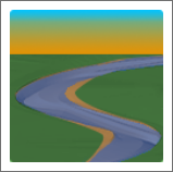
Stream Tools is a Civil3d plug-in used to create stream channel three-dimensional surfaces. This tool allows the user to define reference cross-section parameters for riffles, pools, runs, and glides and then prorates these features along a stream channel alignment.

Download the Stream Tools App


Stream Tools Help File


Stream Tools REM Utility is a Civil3d plug-in used to assign elevations to polylines from a profile on an alignment that the polyline crosses. This is helpful for creating reference surfaces for relative elevation mapping. The profile can represent any reference elevation such as bankfull, water surface, or top of bank.
Download the Stream Tools REM Utility App
Stream Tools REM Utility Help File
GAT is an open source point processing tool that was developed to enable individuals and groups to project points to an alignment and develop hydraulic parameters that then may be used to inform the division making process. This software is provided as-is and updated based on time availability until an outside funding source may be identified.


YouTube Demonstration
A quick GAT App tutorial

The station offset plugin was developed to allow geomorphic survey point processing to be completed in QGIS.
Station Offset Help File


